Trail
Days |
Date |
DOW |
Start |
Finish |
Miles |
Total |
Notes |
| 148 |
Jul 20 |
Wed |
Katahdin Stream
Campground |
Katahdin!! |
5.2 |
2189.1 |
100% of
the trail completed! Hiked from 6:05am to 11:27am. |
| 147 |
Jul 19 |
Tue |
Rainbow Spring Campsite |
Katahdin Stream
Campground |
21.0 |
2183.9 |
Hiked
from 4:19am to 5:19pm. |
| 146 |
Jul 18 |
Mon |
Whitehouse Landing |
Rainbow Stream Campsite |
19.5 |
2162.9 |
Hiked
from 5:59am to 6:52pm. |
| 145 |
Jul 17 |
Sun |
Cooper Brook Falls
Lean-to |
Whitehouse Landing |
14.0 |
2143.4 |
Hiked
from 5:20am to 1:36pm. |
| 144 |
Jul 16 |
Sat |
Sidney Tappan Campsite |
Cooper Brook Falls
Lean-to |
17.1 |
2129.4 |
Hiked
from 4:33am to 4:18pm. |
| 143 |
Jul 15 |
Fri |
Just N. of Ironworks Rd |
Sidney Tappan Campsite |
7.7 |
2112.3 |
Starting out at 6:55 -
stopped for a short day at Sidney Tappan
Campsite. |
| 142 |
Jul 14 |
Thu |
Bodfish Farm Tote Rd |
Just N. of Ironworks Rd |
15.8 |
2104.6 |
Left this morning before
5 am to beat the heat. Today was
even hotter than yesterday. Trying to keep hydrated and maintain my
electrolyte intake. Seeing my first view of Mt. Katahdin in the far
distance. Tomorrow morning, I will be getting a package drop at
Ironworks Rd. |
| 141 |
Jul 13 |
Wed |
ME 15 |
Bodfish Farm Tote Rd |
14.2 |
2088.8 |
Starting the 100-mile
wildeness. Heat index was 92°F! Very hot day of hiking. Was
going
to hike to Long Pond Stream Lean-to, but heard that the shelter was
infested with rodents; and they were chewing holes through the hikers'
packs.
95% of
the trail completed. |
| 140 |
Jul 12 |
Tue |
Shirley-Blanchard Rd. |
ME 15 |
6.3 |
2074.6 |
Short day, then back to
Shaw's. |
| 139 |
Jul 11 |
Mon |
Moxie Pond - Trestle Rd |
Shirley-Blanchard Rd. |
18.5 |
2068.3 |
Hiked from 6:46a-5:31p.
Staying at Shaw's Lodging in Monson. |
| 138 |
Jul 10 |
Sun |
Pierce Pond Lean-to |
Moxie Pond - Trestle Rd |
15.9 |
2049.8 |
Hiked from 6:42a-7:36p.
Crossed the Kennebec River in a canoe
at 9:30am. Water was so low they got stuck on a rock during the ride. |
| 137 |
Jul 09 |
Sat |
E. Flagstaff Rd. NOBO |
Pierce Pond Lean-to |
16.3 |
2033.9 |
On the trail at 6:42
heading north, finished up at 3:33. |
| 136 |
Jul 08 |
Fri |
E. Flagstaff Rd. SOBO |
Stratton Brook Pond Rd. |
15.8 |
2017.6 |
Hiked from 5:51am-5:34pm
through the Bigelows, then
back to Stratton Motel. |
| NOWA's 2016
Appalachian Trail Journal. NOWA
is raising money for the
Alzheimer's Association '"The Longest Day."
|
| 135 |
Jul 07 |
Thu |
Caribou Valley Rd. |
Stratton Brook Pond Rd. |
9.2 |
2001.8 |
On the trail at 6:18,
done at 12:27, back at Stratton Motel. Saw bear and moose. Rain
downpour was after he was off the trail. Resting up before doing the Bigelow
Boogie
tomorrow from 1200' to over 4145' then back down to
1250'. |
| 134 |
Jul 06 |
Wed |
Perham Stream |
Caribou Valley Rd. |
8.6 |
1992.6 |
Hike involved 1/2 mile
of cliff hiking (could have used rappelling gear), then staying at
Stratton Motel. Saw bear and moose. Streams are running, but bogs are
not too wet. |
| 133 |
Jul 05 |
Tue |
Perham Stream. SOBO |
ME 4 |
15.3 |
1984.0 |
Back to ME 4 past
where Geraldine "Inchworm" Largay got
lost back in 2013 after he had met her on the trail, then to Farmhouse
Inn. 90% of
the trail completed. |
| 132 |
Jul 04 |
Mon |
ME 17 |
ME 4 |
13.2 |
1968.7 |
Start at 6:43, then to
Farmhouse Inn. |
| 131 |
Jul 03 |
Sun |
South Arm Rd. NOBO |
ME 17 |
13.2 |
1955.5 |
Start at 6:26, ford
Bemis Stream, then to Pine Ellis Lodging. |
| 130 |
Jul 02 |
Sat |
South Arm Rd. SOBO |
Andover-East B. Hill Rd. |
10.1 |
1942.3 |
On the trail at 6:26am,
back to Pine Ellis Lodging. Was a bit out of shape when he started so
he is doing the Slackpacker
Waltz.
(Switching hiking
northbound and southbound to maximize nights at lodging places that
provide shuttles to hike without carrying a pack) |
| 129 |
Jul 01 |
Fri |
Grafton Notch - ME 26 |
Andover-East B. Hill Rd.
|
10.3 |
1932.2 |
Resting up back at Pine
Ellis Lodging in Andover. |
| 128 |
Jun 30 |
Thu |
The Libby House Inn |
Grafton Notch - ME 26 |
11.4 |
1921.9 |
Back on the trail.
"Ranger" and "Wildflower" helped him
through the Mahoosuc Notch, what some consider the toughest mile on the
AT. Resting up at
Pine Ellis Lodging in Andover. |
| Below
is his 2013
hiking
that left - 275.4 miles left in Maine |
| 127 |
Dec 28 |
Sat |
Bake Oven Rd. |
Blue Mtn. / Little Gap |
13.7 |
1910.5 |
NOBO. PA is completed! |
| 126 |
Dec 27 |
Fri |
Wind Gap - Rt 33 |
Blue Mtn. / Little Gap |
15.3 |
1896.8 |
SOBO. |
| 125 |
Dec 09 |
Mon |
Delaware Water Gap |
Wind Gap - Rt 33 |
15.6 |
1881.5 |
(1289.3-1273.7) Hiking
SOBO - 29.1 miles of PA left. Too icy
to keep hiking this week. |
| 124 |
Dec 08 |
Sun |
Hawk Mtn Road |
Bake Oven Knob Road |
16.3 |
1865.9 |
(1244.6) 85% of
the trail completed. |
| 123 |
Dec 07 |
Sat |
Port Clinton |
Hawk Mtn Road |
15.1 |
1849.6 |
(1228.3) |
| 122 |
Dec 06 |
Fri |
Near 183 |
Port Clinton |
14.1 |
1834.5 |
(1213.2) Very wet hiking
day. |
| 121 |
Dec 05 |
Thu |
PA 72 - Swatara S.P. |
Near 183 |
21.2 |
1820.4 |
(1199.1) Very wet hiking
day. |
| 120 |
Dec 04 |
Wed |
PA 325
|
PA 72 - Swatara S.P. |
17.4 |
1799.2 |
(1177.9) |
| 119 |
Dec 03 |
Tue |
Duncannon
|
PA 325 |
18.0 |
1781.8 |
(1160.5) |
| 118 |
Nov 16 |
Sat |
Duncannon
|
Boiling Springs |
25.6 |
1763.8 |
From Doyle back
to
Allenberry Resort. 80%
of
the trail completed. |
| 117 |
Nov 15 |
Fri |
Boiling Springs
|
Pine Grove Furnace S.P. |
19.6 |
1738.2 |
From the Allenberry
Resort back to the A.T. Museum |
| 116 |
Oct 28 |
Mon |
US 30 |
Pine Grove Furnace S.P. |
19.5 |
1718.6 |
(1097.3) Caledonia S.P.
to the A.T. Museum |
| 115 |
Oct 09 |
Wed |
Pen-Mar Road |
US 30 |
17.9 |
1699.1 |
(1077.8) |
| On
the move again in
Pennsylvania
from where he was on
May 31st. |
| . |
Jul 23 |
Tue |
. |
. |
. |
. |
He will be having
surgery on his left rotator cuff on
Friday at 10:30. He had the same surgery on his right rotator cuff five
years ago so he knows recovery will take some time. |
| . |
Jul 18 |
Thu |
. |
. |
. |
. |
He is scheduled for an
MRI, so he will know more after that
is read and after he sees his surgeon. |
| 114 |
Jul 15 |
Mon |
Full Goose Shelter |
Mahoosuc Notch (S) |
1.5 |
1681.2 |
(1910.5) Slipped and
fell descending to the Mahoosuc
Notch.
Chase carried both packs and they took the Mahoosuc Notch
Trail
out to a dirt
road and followed it to Success Pond Road. There a power company
employee stopped and took him straight to the hospital in Berlin, NH.
He needed some stiches and based on the X-ray he tore his bicep and may
have torn muscles or tendons in his rotator cuff. He will be
heading to the airport to fly home.
"If
either of them falls
down, one can help the other up. But pity anyone who falls and has no
one to help them up." - Ecclesiastes 4:10 |
| 113 |
Jul 14 |
Sun |
Gentian Pond Shelter |
Full Goose Shelter |
9.6 |
1679.7 |
(1909.0) Crossed into
Maine. |
| 112 |
Jul 13 |
Sat |
White Mtns. Lodge
& Hostel |
Gentian Pond Shelter |
11.7 |
1670.1 |
(1899.4) |
| 111 |
Jul 12 |
Fri |
Carter Notch Hut |
US-2 White Mtns. Lodge
& Hostel |
15.0 |
1658.4 |
(1887.7) Staying at the
White Mountains Lodge &
Hostel |
| 110 |
Jul 11 |
Thu |
Pinkham Notch NH-16 |
Carter Notch Hut |
6.2 |
1643.4 |
(1872.7)
75%
of the trail completed. |
| 109 |
Jul 10 |
Wed |
Madison Spring Hut |
Pinkham Notch NH-16 |
7.8 |
1637.2 |
(1866.5) Staying at the
Joe Dodge Lodge |
| 108 |
Jul 09 |
Tue |
Mizpah Spring Hut |
Madison Spring Hut |
11.8 |
1629.4 |
(1858.7) |
| 107 |
Jul 08 |
Mon |
Zealand Falls Hut |
Mizpah Spring Hut |
14.3 |
1617.6 |
(1846.9) |
| 106 |
Jul 07 |
Sun |
Garfield Ridge Shelter |
Zealand Falls Hut |
9.5 |
1603.3 |
(1832.6) |
| 105 |
Jul 06 |
Sat |
Franconia Notch - US 3 |
Garfield Ridge Shelter |
10.3 |
1593.8 |
(1823.1) Rough part of
the trail for friends to start
hiking along. |
| 104 |
Jul 05 |
Fri |
Kinsman Notch NH-112 |
Franconia Notch - US 3 |
16.3 |
1583.5 |
(1812.8) Hiked 14 hours
to cover 16.3 miles. Welcome to
the
Whites. Staying in North Woodstock with some friends who drove up to
join him today. |
| 103 |
Jul 04 |
Thu |
Kinsman Notch NH-112 |
NH-25A |
19.1 |
1567.2 |
(1796.5) Got a shuttle
to Kinsman Notch and
slack-packed SOBO up over Mt. Moosilauke and back to NH-25. Then got
shuttled to NH-25A and hiked NOBO back to NH-25 to stay at
the Hikers Welcome Hostel again tonight.
|
| 102 |
Jul 03 |
Wed |
Grafton Turnpike |
NH-25A |
16.1 |
1548.1 |
(1777.4)
Got a shuttle to the Hikers Welcome Hostel in Glencliff. Now 15.3 miles
and a 3,750' climb away from Mt. Moosilauke. |
| 101 |
Jul 02 |
Tue |
Norwich, VT |
Grafton Turnpike |
20.0 |
1532.0 |
(1761.3) 70%
of the trail completed. Hiked
from Elm St. in Norwich to Hanover, NH and ate breakfast. Then got a
ride out to Grafton Turnpike and hiked back to Hanover, NH. (Good place
to listen to the
song Hungry Heart - "Got a
wife and kids in Baltimore,
Jack...") Some
of the boardwalks are flooded, water is flowing down parts of the
trail, and very hard rain for hours at a time. Very miserable hiking
conditions! |
| 100 |
Jul 01 |
Mon |
Ascutney Mountain |
Elm Street, Norwich, VT |
21.5 |
1512.0 |
(1741.3) Vermont
has set a rainfall record. The National Weather Service reports that
May and June has been the wettest two-month consecutive stretch in
Burlington on record, with a total of 18.6 inches of rain. The weather
service says 8.74 inches fell in May, and 9.86 inches fell in June.
May's statistic lists the month as the wettest May on record. |
| 99 |
Jun 30 |
Sun |
VT 100 |
Ascutney Mountain |
18.9 |
1490.5 |
(1719.8)
Actually had a dry trail today. Sleeping on top of the
mountain with a beautiful view. |
| 98 |
Jun 29 |
Sat |
Governor Clement Shelter |
VT 100 |
13.9 |
1471.6 |
(1700.9) Tough 2-1/2
hour climb up Killington Peak
to begin the day. Completed the Long Trail overlap. Headed into the
Greenbriar Inn. Feet have been constantly wet all but 2 of the past 12
days. The trail is extremely wet. |
| 97 |
Jun 28 |
Fri |
Little Rock Pond Shelter |
Governor Clement Shelter |
19.4 |
1457.7 |
(1687.0) |
| 96 |
Jun 27 |
Thu |
Bromley Shelter |
Little Rock Pond Shelter |
17.8 |
1438.3 |
(1667.6) 65%
of the trail completed. |
| 95 |
Jun 26 |
Wed |
Spruce Peak Shelter |
Bromley Shelter |
4.8 |
1420.5 |
(1649.8) Went
into Manchester Center and then
a
couple more miles to the Bromley Shelter. Pouring rain kept him from
going another 8.1 miles to the Peru Peak Shelter. Really getting
discouraged
with the heavy rains and no way to dry clothes for awhile. |
| 94 |
Jun 25 |
Tue |
Story Spring Shelter |
Spruce Peak Shelter |
18.3 |
1415.7 |
(1645.0) Had a close
encounter with a territorial moose
on Stratton Mtn. |
| 93 |
Jun 24 |
Mon |
VT 9 |
Story Spring Shelter |
19.0 |
1397.4 |
(1626.7) |
| 92 |
Jun 23 |
Sun |
Seth Warner Shelter |
VT 9 |
11.5 |
1378.4 |
(1607.7) Tripped and hit
his knee today. A bit sore
going
down hills. Took a short day and headed into Bennington, VT to resupply. |
| 91 |
Jun 22 |
Sat |
Cheshire, MA |
Seth Warner Shelter |
21.6 |
1366.9 |
(1596.2) Climbed up over
2,500' in elevation
to Mt.
Greylock 3,491'. Crossed into Vermont the 12th state. Now
getting
double miles as the Long Trail overlaps with the A.T. for
105.2
miles. |
| 90 |
Jun 21 |
Fri |
Washington Mtn. Road |
Cheshire, MA |
18.3 |
1345.3 |
(1574.6) Staying at St.
Mary of the Assumption Church |
| 89 |
Jun 20 |
Thu |
Mt. Wilcox North Lean-to |
Washington Mtn. Road |
25.1 |
1327.0 |
(1556.3) 60%
of the trail completed. Must be camping at the home of the "Cookie
Lady". |
| 88 |
Jun 19 |
Wed |
Jug End Road |
Mt. Wilcox North Lean-to |
17.9 |
1301.9 |
(1531.2) |
| 87 |
Jun 18 |
Tue |
Lions Head Trail |
Jug End Road |
14.7 |
1284.0 |
(1513.3) Crossed
into Massachusetts the 11th
state. |
| 86 |
Jun 17 |
Mon |
Sharon Mtn. |
Lions Head Trail |
16.9 |
1269.3 |
(1498.6) Staying at Bearded
Woods again. |
| 85 |
Jun 16 |
Sun |
... off trail ... |
. |
0.0 |
. |
Returning to the trail. |
| 84 |
Jun 15 |
Sat |
... off trail ... |
. |
0.0 |
. |
. |
| 83 |
Jun 14 |
Fri |
... off trail ... |
. |
0.0 |
. |
. |
| 82 |
Jun 13 |
Thu |
... off trail ... |
. |
0.0 |
. |
Healing up. Should be
ready to hike again on Monday. |
| 81 |
Jun 12 |
Wed |
... off trail ... |
. |
0.0 |
. |
Hudson (of Bearded
Woods) went above and beyond
providing
transportation to a hospital to get the infected toe treated and then
to the airport. Flying home tonight for a wedding. |
| 80 |
Jun 11 |
Tue |
Stewart Hollow Brook
Lean-to |
Sharon Mtn. at
"woods" road |
11.8 |
1252.4 |
(1481.7) Feet have
expanded - shoes have contracted,
resulting blister got infected walking through all the swampy areas.
Spent the night at Bearded
Woods One-of-a-Kind Bunk
&
Dine. Best hostel stay so far. They had 207 hikers last year. Shuttle
service, shower, laundry, dinner, breakfast, male & female
bunkrooms. |
| 79 |
Jun 10 |
Mon |
Wiley Shelter |
Stewart Hollow Brook
Lean-to |
19.7 |
1240.6 |
(1469.9) Raining hard
tonight. Going to bed early to get dry and warm. St. Johns Ledges stone
steps were wet and slippery. |
| 78 |
Jun 09 |
Sun |
Hosner Mtn. Rd. |
Wiley Shelter |
22.1 |
1220.9 |
(1450.2) 55%
of the trail completed. |
| 77 |
Jun 08 |
Sat |
US 9/NY 403 |
Hosner Mtn. Rd. |
22.9 |
1198.8 |
(1428.1) |
| 76 |
Jun 07 |
Fri |
Bear Mtn. |
US 9/NY 403 |
8.6 |
1175.9 |
(1405.2) Hiked through
the lowest spot on the trail
(163').
Rained all day, drying things out in Peekskill, NY |
| 75 |
Jun 06 |
Thu |
E. Mombasha Rd. |
Bear Mtn. |
20.2 |
1167.3 |
(1396.6) |
| 74 |
Jun 05 |
Wed |
State Line Trail |
E. Mombasha Rd. |
14.7 |
1147.1 |
(1376.4) |
| 73 |
Jun 04 |
Tue |
Pochuck Mtn. Shelter |
State Line Trail |
15.6 |
1132.4 |
(1361.7) NJ/NY
line. |
| 72 |
Jun 03 |
Mon |
Rutherford Shelter |
Pochuck Mtn. Shelter |
16.7 |
1116.8 |
(1346.1) |
| 71 |
Jun 02 |
Sun |
Buttermilk Falls Trail |
Rutherford Shelter |
19.2 |
1100.1 |
(1329.4) 50%
of the trail completed. |
| 70 |
Jun 01 |
Sat |
Delaware Water Gap, PA |
Buttermilk Falls Trail |
20.9 |
1080.9 |
(1310.2) |
| Jumping
ahead 229.3 miles to NJ
border to save PA section for last. |
| 69 |
May 31 |
Fri |
Pogo Memorial Campsite |
Pen-Mar Road |
14.9 |
1060.0 |
Passed within 5 miles of
Camp David. Crossed the Mason-Dixon line. Got a ride north
to NJ
at 4pm. |
| 68 |
May 30 |
Thu |
Ed Garvey Shelter |
Pogo Memorial Campsite |
19.8 |
1045.1 |
Passing thru the Washington
Monument State Park. |
| 67 |
May 29 |
Wed |
Blackburn AT Center |
Ed Garvey Shelter |
18.8 |
1025.3 |
Harpers Ferry -
Appalachian Trail Conservancy - the
psychological halfway point - time for a photo. Signed in as thru-hiker
#250 so he passed or outlasted 361 other hikers since Springer Mtn. |
| 66 |
May 28 |
Tue |
Rod Hollow Shelter |
Blackburn AT Center |
17.8 |
1006.5 |
Finished the "Roller
Coaster". Late check-in (9:53pm) |
| 65 |
May 27 |
Mon |
Mosby Campsite |
Rod Hollow Shelter |
20.0 |
988.7 |
Memorial Day. 45%
of the trail completed. Ready to start the "Roller Coaster". |
| 64 |
May 26 |
Sun |
Skyline 21.1, Hogback |
Mosby Campsite |
20.2 |
968.7 |
If you started at
Springer Mtn. with $10,000 "bricks"
of
(100) $100 bills and laid them ten wide, you would have a hiking path
26.1" wide and would reach the $1 trillion mark at 969.1 miles. |
| 63 |
May 25 |
Sat |
Skyline 31.2 |
Skyline 21.1, Hogback |
11.0 |
948.5 |
Position as of 2:42pm.
Short day today. |
| 62 |
May 24 |
Fri |
Big Meadows Campground |
Skyline 31.2 |
17.3 |
937.5 |
Got a later start than
normal. Saw a large black bear
near 931. |
| 61 |
May 23 |
Thu |
Hightop Hut |
Big Meadows Campground |
20.8 |
920.2 |
. |
| 60 |
May 22 |
Wed |
Jones Run Trailhead |
Hightop Hut |
19.7 |
899.4 |
. |
| 59 |
May 21 |
Tue |
Jones Run Trailhead |
Rockfish Gap, Waynesboro |
22.2 |
879.7 |
Hiking SOBO back to
Waynesboro. 40%
of the trail
will be completed by tonight. In the Shenandoah National Park |
| 58 |
May 20 |
Mon |
Maupin Field Shelter |
Rockfish Gap, Waynesboro |
21.0 |
857.5 |
. |
| 57 |
May 19 |
Sun |
Seeley-Woodworth Shelter |
Maupin Field Shelter |
20.4 |
836.5 |
End of Trail Days in
Damascus |
| 56 |
May 18 |
Sat |
US-60 / Buena Vista, VA |
Seeley-Woodworth Shelter |
14.0 |
816.1 |
Up
to 60 injured after car drives into Trail Days parade. |
| 55 |
May 17 |
Fri |
Johns Hollow Shelter |
US-60 / Buena Vista, VA |
20.1 |
802.1 |
Hit the trail at 6am for
an early start. Arrived at
US-60 at 4:29pm and heading 9.3 miles into
Buena Vista. Start of Trail Days in Damascus -
plan is to go next year. |
| 54 |
May 16 |
Thu |
Cornelius Shelter |
Johns Hollow Shelter |
21.6 |
782.0 |
35%
of the trail completed. Shelters should be clearing up as hikers
migrate to Damascus for Trail Days. |
| 53 |
May 15 |
Wed |
Bobblets Gap Shelter |
Cornelius Shelter |
18.4 |
760.4 |
Exciting day meeting a
rattlesnake up close on the trail!
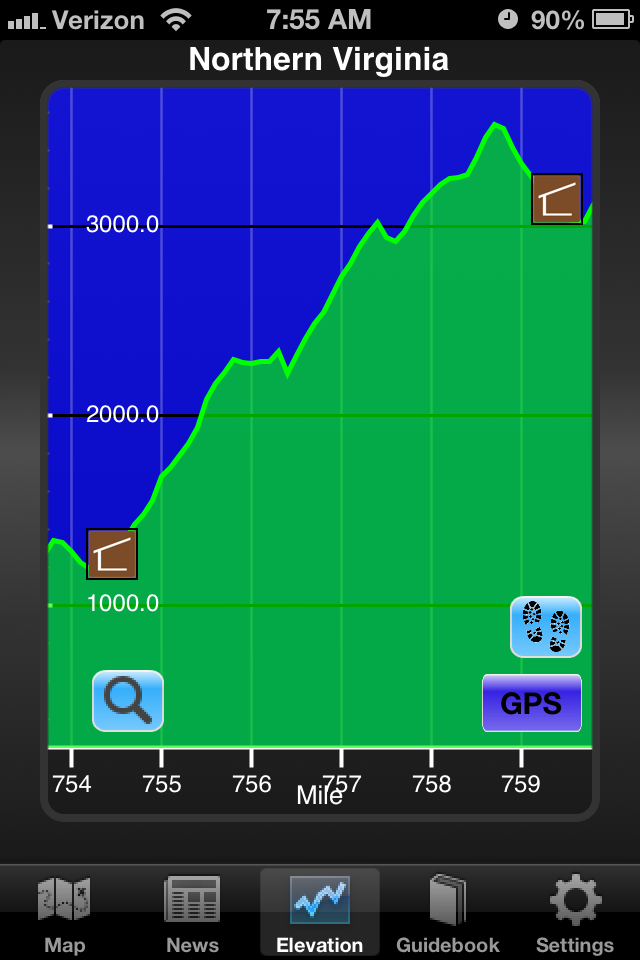
Long rough climb up Floyd Mtn. (see AT Hiker screen image below)
|
| 52 |
May 14 |
Tue |
US 220 |
Bobblets Gap Shelter |
18.5 |
742.0 |
Shelters should clear as
many hikers migrate to Damascus. |
| 51 |
May 13 |
Mon |
VA 311 |
US 220 |
19.8 |
723.5 |
Daleville, VA |
| 50 |
May 12 |
Sun |
Pickle Branch Shelter |
VA 311 |
12.6 |
703.7 |
Stayed at the Four Pines
Hostel. Got a shuttle to VA
311 and
hiked back to the hostel. Will start from VA 311 on Monday. |
| 49 |
May 11 |
Sat |
Laurel Creek Shelter |
Pickle Branch Shelter |
22.5 |
691.1 |
Confirmed at 7:27pm |
| 48 |
May 10 |
Fri |
Pine Swamp Branch
Shelter |
Laurel Creek Shelter |
18.5 |
668.6 |
30%
of the trail completed. |
| 47 |
May 09 |
Thu |
Pearisburg, VA |
Pine Swamp Branch Shelter |
19.3 |
650.1 |
. |
| 46 |
May 08 |
Wed |
Woods Hole Hostel |
Pearisburg, VA |
10.4 |
630.8 |
. |
| 45 |
May 07 |
Tue |
VA 606, Trent's Grocery |
Woods Hole Hostel |
14.9 |
620.4 |
. |
| 44 |
May 06 |
Mon |
Bland, VA |
VA 606, Trent's Grocery |
18.4 |
605.5 |
Raining very hard today. |
| 43 |
May 05 |
Sun |
Davis Farm Campsite |
Bland, VA |
14.9 |
587.1 |
On Bushy Mtn at 1pm.
Heading into Bland to eat a couple
dinners. |
| 42 |
May 04 |
Sat |
VA 42 |
Davis Farm Campsite |
18.2 |
572.2 |
Got an update on May
5th. Very cold above 3,800' at
night. |
| 41 |
May 03 |
Fri |
USFS 86 / Glade Mtn. Rd. |
VA 42 |
19.2 |
554.0 |
25%
of the trail completed. |
| 40 |
May 02 |
Thu |
Dickey Gap |
USFS 86 / Glade Mtn. Rd. |
18.7 |
534.8 |
Back to Dickey Gap and
northbound. |
| 39 |
May 01 |
Wed |
Campsite (N of Lost Mtn) |
Damascus, VA |
17.0 |
516.1 |
Back in Damascus. |
| 38 |
Apr 30 |
Tue |
Wise Shelter |
Campsite (N of Lost Mtn) |
15.9 |
499.1 |
1.4 miles north of Lost
Mtn Shelter |
| 37 |
Apr 29 |
Mon |
Dickey Gap |
Wise Shelter |
16.1 |
483.2 |
Plans to hike SOBO from
Dickey Gap / Troutdale 49.5
miles back to Damascus. |
| 36 |
Apr 28 |
Sun |
Abingdon Gap Shelter |
Damascus, VA |
10.4 |
467.1 |
Drying off in Damascus. |
| 35 |
Apr 27 |
Sat |
TN-91 |
Abingdon Gap Shelter |
11.3 |
456.7 |
Back on the trail - may
have had Hyponatremia - "a
condition that occurs when the level of sodium in your blood
is abnormally low. Sodium is an electrolyte, and it helps
regulate
the amount of water that's in and around your cells. In hyponatremia,
one or more factors — ranging from an underlying medical
condition to drinking too much water during endurance sports
—
causes the sodium in your body to become diluted. When this happens,
your body's water levels rise, and your cells begin to swell. This
swelling can cause many health problems, from mild to severe." - Mayo
Clinic |
| 34 |
Apr 26 |
Fri |
Iron Mountain Shelter |
TN-91 |
4.6 |
445.4 |
Other leg is really
hurting. Got a ride into Damascus. Might be low on sodium and
potassium. Drinking Gatorade, etc. |
| 33 |
Apr 25 |
Thu |
Pond Flats |
Iron Mountain Shelter |
19.1 |
440.8 |
20%
of the trail completed. |
| 32 |
Apr 24 |
Wed |
Vango/Abby's Place |
Pond Flats |
16.9 |
421.7 |
. |
| 31 |
Apr 23 |
Tue |
Linville, NC |
Vango/Abby's Place |
13.2 |
404.8 |
On the trail again!
Felt pretty good this morning. |
| 30 |
Apr 22 |
Mon |
Linville, NC |
Linville, NC |
0.0 |
391.6 |
Norovirus symptoms have
passed. Leg still hurts. May not
resume hiking until Thursday. |
| 29 |
Apr 21 |
Sun |
Mountain Harbour Hostel |
Linville, NC |
0.0 |
391.6 |
Looking for a hotel -
has the symptoms of Norovirus. |
| 28 |
Apr 20 |
Sat |
Mountain Harbour Hostel |
Mountain Harbour Hostel |
0.0 |
391.6 |
Took a "zero" to rest
up. Got two knots worked out of his
calf muscles so he is hoping to be hiking tomorrow. |
| 27 |
Apr 19 |
Fri |
Campsite near Hump Mtn. |
Mountain Harbour Hostel |
6.2 |
391.6 |
Very high winds this
morning. Bad weather, short day. |
| 26 |
Apr 18 |
Thu |
Greasy Creek Friendly |
Campsite near Hump Mtn. |
19.1 |
385.4 |
Has been camping alone
to avoid the norovirus. |
| 25 |
Apr 17 |
Wed |
Low Gap Campsite |
Greasy Creek Friendly |
9.4 |
366.3 |
Rainy today and he was
soaked. |
| 24 |
Apr 16 |
Tue |
Uncle Johnny's |
Low Gap Campsite |
16.4 |
357.9 |
His feet have been
starting to hurt, so he may/should be reducing his daily miles. |
| 23 |
Apr 15 |
Mon |
Whistling Gap |
Uncle Johnny's |
12.9 |
341.5 |
Stopping at Uncle
Johnny's for a mail drop. |
| 22 |
Apr 14 |
Sun |
near Rector Laurel road |
Whistling Gap |
19.2 |
328.6 |
15%
of the trail completed. Lots of hikers are getting sick with the
Norovirus. "Norovirus is a very contagious virus that can infect
anyone. You can get it from an infected person, contaminated food or
water, or by touching contaminated surfaces. The virus causes your
stomach or intestines or both to get inflamed. This leads you to have
stomach pain, nausea, and diarrhea and to throw up." - CDC
website |
| 21 |
Apr 13 |
Sat |
Hemlock Hollow Inn |
near Rector Laurel road |
19.2 |
309.4 |
exact waypoint uncertain |
| 20 |
Apr 12 |
Fri |
Hot Springs, NC |
Hemlock Hollow Inn |
16.3 |
290.2 |
. |
| 19 |
Apr 11 |
Thu |
Groundhog Creek Shelter |
Hot Springs, NC |
26.2 |
273.9 |
Climbed over Max Patch
Summit. Storms stayed to the
west so
he walked a full marathon today to Elmer's Sunnybank Inn. |
| 18 |
Apr 10 |
Wed |
Cosby Knob Shelter |
Groundhog Creek Shelter |
17.6 |
247.7 |
Stopped briefly at Standing
Bear Hostel for a mail
drop. |
| 17 |
Apr 09 |
Tue |
Icewater Spring Shelter |
Cosby Knob Shelter
|
20.3 |
230.1 |
10%
of the trail completed. Long day, checked in at
6:47pm. |
| 16 |
Apr 08 |
Mon |
Double Spring Gap Shelter |
Icewater Spring Shelter |
13.8 |
209.8 |
Climbed over Clingmans
Dome (highest point on AT) and headed
into Gatlinburg, TN to resupply - then back on trail for 3
more
miles. He said it was awful from Clingman to Gatlinburg. The
ice was so thick and slippery. He said there were reports of
hikers falling and fracturing ankles and wrists. |
| 15 |
Apr 07 |
Sun |
Spence Field Shelter |
Double Spring Gap Shelter |
13.5 |
196.0 |
183.7 - "Wish that I was
on ole Rocky Top, down in the
Tennessee hills. Ain't no smoggy smoke on Rocky Top, ain't no telephone
bills..." |
| 14 |
Apr 06 |
Sat |
Fontana Dam Shelter |
Spence Field Shelter |
16.7 |
182.5 |
. |
| 13 |
Apr 05 |
Fri |
Stecoah Gap, NC 143 |
Fontana Dam Shelter |
15.1 |
165.8 |
. |
| 12 |
Apr 04 |
Thu |
Sassafras Gap Shelter |
Stecoah Gap, NC 143 |
6.7 |
150.7 |
Cold and pouring rain.
Ice on the trees and everything is
soaked. Staying at The
Cabin in the Woods Reports of
more snow in the Smokies. |
| 11 |
Apr 03 |
Wed |
Cold Spring Shelter |
Sassafras Gap Shelter |
18.4 |
144.0 |
Stopped at NOC for mail
drop. |
| 10 |
Apr 02 |
Tue |
Winding Stair Gap |
Cold Spring Shelter |
15.8 |
125.6 |
Started out at 9:41am |
| 9 |
Apr 01 |
Mon |
Long Branch Shelter
(2013) |
Winding Stair Gap |
7.3 |
109.8 |
5%
of the trail completed. Resupplying in Franklin.
Drying clothes and shoes. |
| 8 |
Mar 31 |
Sun |
Deep Gap, USFS 71 |
Long Branch Shelter
(2013) |
17.1 |
102.5 |
Climbed over Standing
Indian Mtn. & Albert Mtn. |
| 7 |
Mar 30 |
Sat |
Dicks Creek Gap |
Deep Gap, USFS 71 |
15.8 |
85.4 |
Hiked some with "Apostle
Paul". Crossed the GA/NC line. |
| 6 |
Mar 29 |
Fri |
Tray Mountain Shelter |
Dicks Creek Gap |
11.0 |
69.6 |
At the Blueberry Patch
Hostel. |
| 5 |
Mar 28 |
Thu |
Cold Springs Gap |
Tray Mountain Shelter |
11.5 |
58.6 |
. |
| 4 |
Mar 27 |
Wed |
Neel Gap |
Cold Springs Gap |
16.4 |
47.1 |
. |
| 3 |
Mar 26 |
Tue |
Gooch Gap |
Neel Gap |
13.5 |
30.7 |
Snow blowing across
trail, slippery going down to Mountain
Crossings. Clothes getting
washed.
Reports of a foot of snow in the
Smokies.
Waiting on permit
to hike
in the "Smokies". |
| 2 |
Mar 25 |
Mon |
Hawk Mtn. Shelter |
Gooch Gap |
9.1 |
17.2 |
Snow, ice, freezing
water bottles. Headed in to Suches, GA |
| 1 |
Mar 24 |
Sun |
Amicalola Falls S.P. |
Hawk Mtn. Shelter |
8.1 |
8.1 |
Pouring rain all day and
dropping temperatures. Signed in as thru-hiker #611. |
| 0 |
Mar 23 |
Sat |
Ohio |
Amicalola Falls S.P. |
. |
. |
On trail, Thank You to
everyone, Now it"s time to hike! |
 Send
an email
Send
an email 


 State Boundaries,
  Hostels,
  Key Points,
  Trail Community,
  Key Mtns.
